
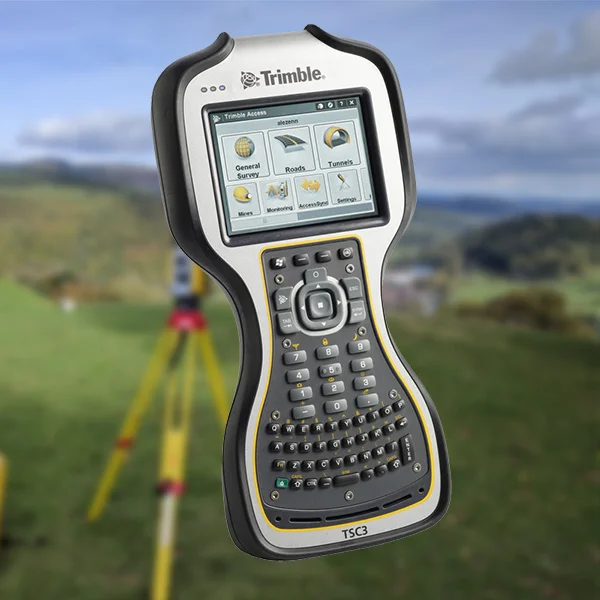
The TSC3 Trimble Survey Controller (TSC for short) has a few options to aid in setting up your instrument, each with its own pros and cons. In this article, I’ll aim to explain how each Station Setup mode works and in which scenario you would use it.
Below is the list of all options available to do a setup with the TSC3 Trimble controllers in a Trimble Instrument:
- Station Setup
- Station Setup Plus
- Resection (Free Station)
- Refline
- Traverse on the TSC3 Trimble Controller
- (optional) Station Elevation
Station Setup
This method is best suited when you have known coordinates of the points. First, you need to set up the instrument above one point and then you have to determine the orientation of the setup. This can be done in two different ways:
Orientation with a given azimuth
This is the simplest case, where the azimuth to a distant target is known. Aim to this target and then measure the horizontal angle. You can now calculate the orientation of the circle of the total station. If you do not need to orientate the instrument to true north, the azimuth to a visible target is often set to zero.
Orientation with given backsight coordinates
If you have two points of known coordinates, you can set up over one of them and backsight the other one for orientation. With the given coordinates of both station and backsight point, you can calculate the azimuth and the orientation angle. To do this first set up the instrument over the station point, then set up a tripod with a prism or a prism rod at the backsight point and then measure both the angle and distance.
This is the most common method used when setting up and it is useful in applications where control coordinates are known or unknown.
Advantages
- Simple and fast procedure.
- Use it even if no coordinates are known. In this case, you can work with any coordinates for the station and any azimuth for the orientation.
- It is the best procedure to use when you work with one station only.
- Use it when points are measured from a first station point when the station point can be used again as a station and/or a backsight point.
Disadvantages
- If you build up a local network, always working with the simple station setup method and using one backsight point only that was measured from a previous station, a loose net configuration is built that has decreasing internal accuracy. If this station setup is used multiple times in an existing network, the neighborhood relationship of point groups measured from different stations depends strongly on the net quality. But the net quality cannot be checked with this simple setup.
- There is no redundancy in the measurement. So you cannot check if:
- The station point at the site is identical to the point given by the coordinates.
- The correct backsight point was chosen.
- The backsight coordinates are correct.
- The measured or staked point cloud may have good internal geometry but it might be shifted or twisted.
Stationing Setup Plus
Use this method if you need to measure more backsight points to determine the orientation. The station coordinates and the coordinates of the backsight points must be known. You can then calculate the averaged orientation. This method is more suitable than the simple stationing setup when a stationing has to be done in a network that is either given or that is produced by previous measurements.
Advantages
The main advantage when you compare this method to the simple setup is redundancy. With redundant measurements:
- The orientation parameter and the scale factor can be determined more accurately.
- A point mix-up, and either wrong or inaccurate coordinates can be recognized.
- Network constraints can be detected and taken into account.
Disadvantages
- Compared to the simple station setup, you need to allow more time. However, this is the only real disadvantage.
- Compared to resection, you are limited to a given point to set up the instrument. This could lead to problems caused by visibility.
Resection (Free Stationing)
The prerequisites for Resection are similar to those for Station Setup Plus. The only difference is that you can choose the station point, which means that its coordinates are unknown and have to be calculated by the stationing algorithm. However, use this option sparingly as it is highly dependent on the quality of your existing control and on the geometrical configuration in relation to your stationing point.
Advantages
- Because you can choose the station point, you can set up the tripod where there is the best visibility to all points that you need to measure or stake-out, or where there is no obstruction or traffic, or where the highest safety for the observer and the instrument is guaranteed.
- Can improve setup time dramatically when targets are well distributed and visible from multiple positions.
Disadvantages
- From a practical point of view, there are no real disadvantages, but you can use this method only if you have two or more backsight points.
- Can and will offer lower set up quality when poorly configured.
- Not very useful or accurate in sites that long and narrow (e.g. railway corridors, tunnels) if requiring high precision.
- Can often drive a fake sense of confidence in the setup due to the operator’s lack of experience.
Refline
RefLine stationing follows the same principle as Resection, but two backsight points only are used. The points define a local axis or reference line. The coordinates of these points can be known, but this is not required. This method is very useful when looking to set out points relative to another linear feature.
Advantages
Use this method when you need to measure or stake out points related to an axis: It allows many options related to the combination of the local axis and the grid system.
Disadvantages
The program is optimized for specific applications. So far there is no disadvantage compared to another stationing routine.
Traverse on the TSC3 Trimble Controller
Traverse is listed as a COGO function in the TSC3 Trimble Survey Controller software. When you use it, the prerequisite is that local measurements are provided in the form of some stationings where the following station uses the last station as a backsight point.
The following is an example for the measuring procedure:
- Carry out any stationing on the start point with one or more backsight points.
- Measure the next traverse point as a normal topo point.
- Start stationing on this point, using the start point as backsight point and then measure the next traverse point as a normal topo point.
- Continue in this way. On the last traverse point, measure the end point as a normal topo point.
- On the end point, perform a Station Setup Plus routine with one or more backsight points and then measure the last traverse point as a topo point. Alternatively, use the last traverse point as the backsight point and then measure a known point as a topo point.
Traverses are always measured when no known points are available in a larger area. Sometimes using a traverse is a way to quickly obtain new coordinates when you are measuring in an area with subsidence caused by mining or in an active rift zone.
Advantages
The traverse is a well known and well accepted surveying method when environmental conditions mean that a GPS or GNSS measurement is impossible, for example, in a tunnel, forest, mine, or inside a building.
Disadvantages
- A traverse is always an extensive measurement and not the ideal solution with respect to the theory of error propagation. The traverse points in the middle of a longer traverse are always of lower accuracy.
- The traverse will lose its importance with the combination of GNNS and total station, for example in an I. S. Rover instrument, because you can easily measure backsight coordinates with the integrated GNSS receiver for a free stationing.
Station Elevation
Station Elevation is listed with the measuring programs (not under stationing) in the Trimble Survey Controller (TSC3) software. As a result, it requires another 2D or 3D stationing before you can use it. The calculation of the station elevation supplements a 2D stationing with an additional elevation for the station point or replaces the elevation that was calculated in the previous stationing.
Advantages
If the station point or the backsight points have only elevations of lower accuracy, the Station Elevation can use accurate elevations, for example, elevations measured with a level.
Disadvantages
There are no disadvantages, as this method doesn’t directly compare with the other methods explained above.
Conclusion
As you can see there are a few options on the TSC3 Trimble Controller and each is suitable in specific scenarios. It’s hard to say which Station Setup method is the best as it will depend on your circumstances and site configuration.
[…] controllers affected by the 3G switch-off are: TSC3, TSC5, TSC7, T7, T10, T100, […]