
When it comes to Land Surveying, if you use any sort of GNSS (GPS) equipment, you will deal with GNSS orbits even if you don’t realise it. But when it comes to Static GNSS processing, these are critical in obtaining good results in your GNSS processing.
Let’s see what are they and how to download GNSS precise orbits to augment your data processing.
What are GNSS Precise Orbits or Ephemerides?
GNSS Precise Orbits or Ephemerides refer to the precise data sets specifying the orbit parameters for a specific satellite at a specific time1. These data sets are used by GNSS receivers to derive positions2.
The satellites broadcast data about their orbit (ephemeris) on a regular basis. While this ephemeris data is accurate, it’s not as accurate as it could be2. For instance, the original GPS ephemeris had a precision of about a meter, while the newer system Galileo broadcasts data which is three times more precise2.
The International GNSS Service (IGS) provides GNSS orbit products, including ultra-rapid, rapid, and final orbit combination solutions. These solutions are available in the Extended Standard Product-3 (SP3c) format. The ultra-rapid product is useful for real-time and near real-time applications and includes both observed and predicted satellite orbits. The rapid orbit combination is a daily solution, and the final solution, which is the most consistent and highest quality, consists of daily orbit files4.
GNSS Precise Orbits or Ephemeris play a crucial role in navigation and positioning systems, providing the necessary data for GNSS receivers to calculate accurate positions. They are essential for a wide range of applications, from navigation to geodesy, meteorology, and space science.
Types of Orbit Files
GNSS Orbits and Clock Data information is usually distributed in the SP3-d file format (and as a message in a real-time data stream). These IGS products (SP3 files) are typically be classified according to their latency – the length of time between the time of the last observations and the time the file is produced.
| Orbit Type | 3D Accuracy (metres) | Clock Accuracy (ns) | Latency | Updates (days) | |
|---|---|---|---|---|---|
| (ns) | (metres) | ||||
| Broadcast | 2.00 | 7.0 | 2.10 | Real-time | N/A |
| Ultra-rapid (predicted) | 0.10 | 5.0 | 1.50 | Real-time | 0.25 |
| Ultra-rapid (observed) | < 0.05 | 0.2 | 0.06 | 3 hours | 0.25 |
| Rapid | < 0.05 | 0.1 | 0.03 | 17 hours | 1 |
| Final | < 0.05 | < 0.1 | <0.03 | 13 days | 7 |
Broadcast Orbits
Satellites routinely transmit information about their orbits (ephemeris), known as Broadcast Orbits, which GNSS receivers utilize to calculate positions. While this ephemeris data is precise, there’s room for improvement.
The initial GPS ephemeris offered an accuracy of approximately one meter. However, the more recent Galileo system transmits data that is three times more accurate. As advancements in technology and methodologies continue, we can expect the precision of the ephemeris data broadcasted by satellites to improve correspondingly.
Ultra-rapid Orbits
The ultra-rapid product, useful for real-time and near real-time applications, is produced four times per day. the ultra-rapid product includes both observed and predicted satellite orbits.
Rapid Orbits
The Rapid orbit/clock product is combined 17 hours after the end of the day of interest. The latency is mainly due to the varying availability of tracking data from stations of the IGS global tracking network, which use a variety of data acquisition and communication schemes, as well as different levels of quality control.
These orbits are useful when it’s required to obtain more accurate GNSS results before final orbits are available. The variation from final orbits isn’t significant in most practical cases.
Final Orbits
The final, most consistent and highest quality IGS solutions, consist of daily orbit files, generated on a weekly basis approximately 13 days after the end of the solution week. These should be used when the highest degree of accuracy is required.
How often are GNSS orbits updated?
GNSS orbits are updated regularly to ensure the accuracy of positioning and navigation data. Here’s a summary of how often they are updated:
- Broadcast Ephemeris Data: A large percentage of the GNSS sites provide broadcast navigation data in addition to observation data. The Crustal Dynamics Data Information System (CDDIS) creates daily broadcast ephemeris files from these site-specific files transmitted by the stations1. These files contain the unique GPS or GLONASS satellite ephemeris messages for each day1. A similar file is created at the start of the UTC day and updated on an hourly basis from the hourly broadcast navigation files1. Users can therefore download a single file each day or hour, which contains all broadcast ephemeris messages required for post-processing.
- IGS Orbit Products: The International GNSS Service (IGS) provides GNSS orbit products, including ultra-rapid, rapid, and final orbit combination solutions. The ultra-rapid product, useful for real-time and near real-time applications, is archived at regular intervals four times per day. The rapid orbit combination is a daily solution available approximately 17 hours after the end of the previous UTC day. The final, and most consistent and highest quality IGS solutions, consists of daily orbit files, generated on a weekly basis approximately 13 days after the end of the solution week5.
How to download GNSS Orbits?
If you are post-processing GNSS data, you might find that you need to download GNSS Orbits relevant to your GNSS survey. Fortunately, this is very easy to do.
Different types of GNSS Orbits (Ephemeris), including GNSS Precise Orbits, can be downloaded from the Crustal Dynamics Data Information System (CDDIS). This is a service provided by NASA.
To download GNSS Precise Orbits you’ll need to head to the CDDIS Data an Products page (https://cddis.nasa.gov/Data_and_Derived_Products/GNSS/GNSS_data_and_product_archive.html) and select the product type you want from the sidebar. In this example I”ll select “Precise Orbits“.
There are 2 type of GNSS Orbits you can download from here:
- GNSS Orbits – contains orbits for all available GNSS including GPS, GLONASS, GALILEO etc.
- GLONASS only Orbits – contains orbits for GLONASS satellites only.
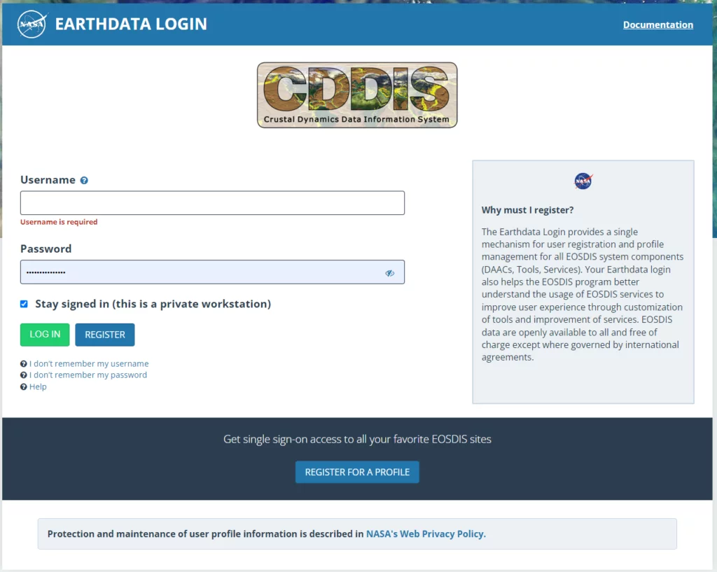
Unless you have a reason to go for GLONASS only orbits, the choice is all GNSS orbits. Once you click on the https://cddis.nasa.gov/archive/gnss/products link, it will redirect you to a login page. You will have to create an Earthdata Login (unless you have one). This is simple and free to do.
Once logged in you will be redirected to a directory containing multiple numbered directories.
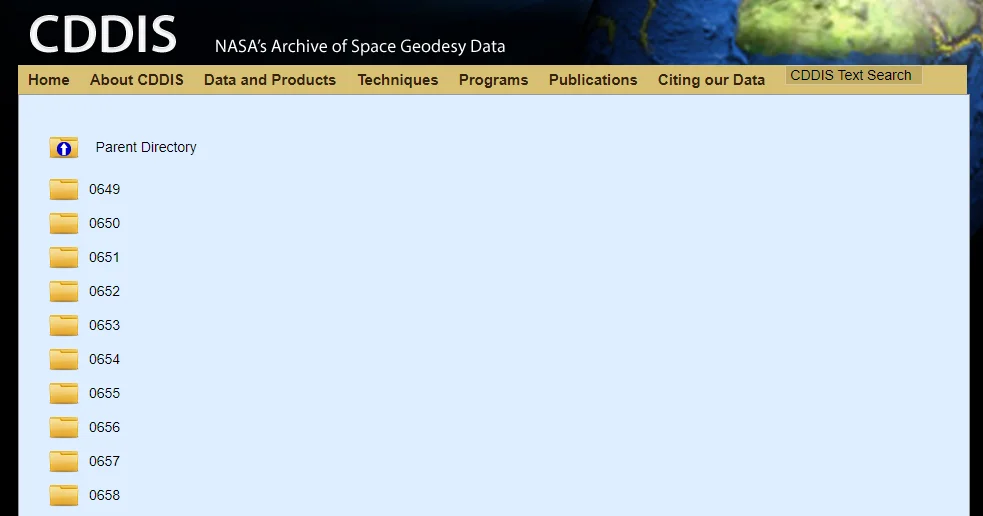
These numbers represent the GPS week in which your GNSS survey was done.
If you don’t know which GPS week you’re after, you can look it up in a GPS Date Calendar. For example, if a survey was done on the 8th of April 2024, that means GPS Week 2309, day 1 (see screenshot below). Also, note down the Julian Day Number (99 in this case).
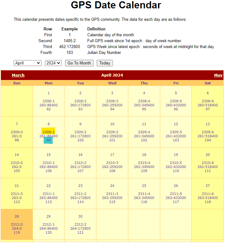
Back in the CDDIS website, search for a folder called 2309 and click on it. The contents of this directory will contain, amongst other things, the GNSS Precise Orbits (SP3 files) you will need. It will contain data for the entire GPS week.
The file naming conventions might look confusing at a first glance, but these are simple to decipher.
AAA0PPPTYP_YYYYDDDHHMM_LEN_SMP_CNT.FMT.gz
Below you’ll see what each section of this file name refers to.
- You can choose any analysis centre (I would typically go for COD as it contains combined orbits for all GNSS types).
- The Campaign specification depends on the date – most likely you’ll go for OPS
- The Solution Type Identifier will be the type of GNSS Orbits you are after (FINAL, RAPID or ULTRA-RAPID) – explained above.
- The Year, Hour and Minute are self-explanatory.
- The LEN will almost always be 1 day (01).
- For the SMP value select the lowest available (different Analysis Centres have different sampling resolutions – COD typically has 05minute resolution)
- Then Format Type will always be ORB.
- And lastly, the Format FMT is always SP3.
| Code | Meaning |
|---|---|
| AAA | Analysis Centre Name |
| PPP | Campaign/Project Specification (OPS or RNN) |
| TYP | Solution Type Identifier (FIN, RAP or ULT) |
| YYYY | 4-digit year (e.g. 2024) |
| DDD | 3-digit day of the year (Julian day of the year) |
| HH | 2-digit hour |
| MM | 2-digit minute |
| LEN | Intended product period |
| SMP | Temporal product sampling resolution |
| CNT | Content Type (ERP, ORB or SUM) |
| FMT | File format (ERP, SP3 or SUM) |
| .gz | gzipped file – the compression type |
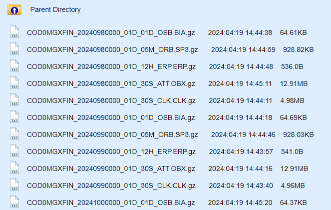
Using the above information, orbits for the 8th of April 2024 would be in a file named:
COD0MGXFIN_20240990000_01D_05M_ORB.SP3.gz
Note the Julian Day of the year highlighted in red.
Once you found the correct file simply click on it to download it. The GNSS Precise Orbits files will be archived in GZIP format. You can extract this into the correct SP3 file by using and modern compression/decompression software such as 7-Zip.
Conclusions
In conclusion, GNSS orbits are updated frequently, ranging from hourly to daily, depending on the specific data product. This ensures the accuracy and reliability of GNSS-based positioning and navigation systems. Downloading them for use in your GNSS post-processing is very easy and free.
- Understanding GNSS Operations: Almanac, Ephemeris, and Receiver Start Modes – Hitechniques ↩︎
- geoscienceaustralia.github.io/ginan/resources/SP3-dQuickReferencev01.pdf ↩︎
- geoscienceaustralia.github.io/ginan/resources/SP3-dQuickReferencev01.pdf ↩︎
- CDDIS | | Data and Derived Products | GNSS | orbit products (nasa.gov) ↩︎
- CDDIS | | Broadcast ephemeris data ↩︎