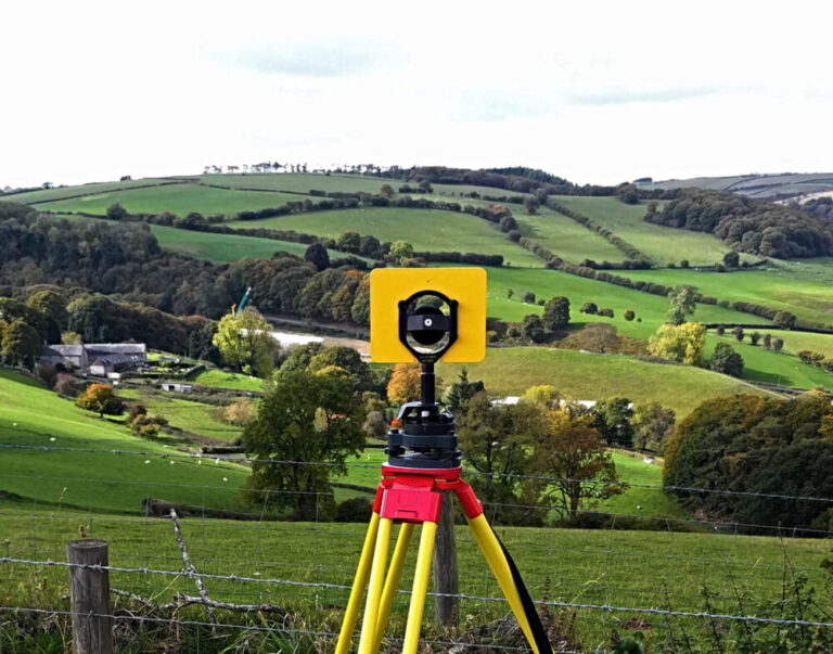
Home » Geomatics Articles

Geomatics Articles

Interesting and helpful articles about Geomatics and all related disciplines such as: Land Surveying, Mapping and Geodesy.
Rendered image of earth and GNSS Satellites in orbit

GNSS vs GPS – what is GNSS?

GNSS (Global Navigation Satellite Systems) is a term used to describe satellite-based systems that provide positioning, navigation, and timing (PNT) data. GNSS is widely used in geomatics and land surveying to accurately determine the position and orientation of points on the Earth's surface. Other uses outside of land surveying include transportation, navigation applications, agriculture and weather forecasting.
Chartwell Yellow Survey Field Book 2647 with blue pen on top

Survey Field Books & Field Notes

Surveying is all about observations. When you go on site, you often need to record not just topographical data, but also notes about your work. Good record keeping is a must have in land surveying, and this is best achieved by always taking essential field notes in your survey field book.
Map of Existing SnakeGrids in the United Kingdom

SnakeGrid – The Ultimate Guide

If you've worked on large engineering projects that span over long but narrow areas, you probably have had difficulties using projected coordinate systems in your surveys....In this article I will explore the meaning of SnakeGrid. I will go over topics like: what is the Snake Grid Coordinate System, what SnakeGrid coordinates are, what are the Snake Grid types out there and SnakeGrid converter software.
Land Surveying Instrument - Digital Level - Geomatics

Land Surveying ⛰️ what is it?

Land Surveying is the process of gathering, collecting, and processing geographical data for creating a informational report about the surveyed area. Land Surveyors gather positional data to produce accurate representation of the shape of the land and anything on it.