Let’s discuss the role of Land Surveyors in society and what Land Surveying implies. Because this article is bound to be large in size, I will split it up in two parts:
- Part 1 – Land Surveying (this post)
- Part 2 – Land Surveyors
In this part I will be discussing about Land Surveying. Read Part 2, where I discuss about Land Surveyors.
survey (verb) – look closely at or examine (someone or something).
Oxford Dictionary
Land Surveying
There are many definitions out there, but most of them will tend to be biased towards specific industries. Whilst all definitions are correct, Land Surveying doesn’t fit in one single industry, but rather spans across multiple disciplines.
I believe the following definition is succinct and encompassing at the same time.
What is Land Surveying
Land Surveying is the process of gathering, collecting, and processing geographical data for creating a informational report about the surveyed area.
Surveying is an essential part in many activities and industries. And it always has been.
Oldest profession
Many professionals in the Geomatics industry believe that Land Surveying is one of the oldest professions in the world. Some of the oldest recorded evidence of it’s existence dates back over 3000 years ago to Ancient Egypt.
„Remove not the boundary stones of the cornland and change not the position of the measuring tape.”
Amenhotpe, son of Kanakht, Teachings, Chapter VI (c. 1400 B.C.)
However, evidence of planned and accurate constructions exist which dates back even further. A few of examples would be:
- Uruk (~4000 BC) – believed to be the world’s first city ever created.
- Shahr-e Sukhteh (3200 BC) – also known as the “Burnt City” in modern day Iran.
- Great Pyramid of Giza (2570 BC) – the largest Egyptian pyramid and the tomb of Fourth Dynasty pharaoh Khufu.
Whilst there is no direct record of Land Surveying, the size and positional alignment of these buildings indicate that a lot of thought and care has been placed into their construction. Precise measurements must have been used in one form or another in the erection of ancient monuments.
Since boundaries of old
One might argue that Land Surveying might go even further in ancient history. Back to the first need of drawing boundaries or maps, where some sort of rudimentary surveying was used to produce them.
Some of the world’s oldest maps date back to ~ 27,000 years ago. This is a map-like representation of a mountain, river, valleys and routes.

We can safely assume that an observation and recording process has been involved in some form or another, dating back to ancient history.
First official profession
Prior to the Ancient Romans, surveying wasn’t really a defined profession, rather it was a collection of isolated practices and techniques. With the advent of the Roman Empire also came the prestige and weight to the field of Land Surveying, which brought the profession of Surveyor to prominence.
With the formation of the Roman Republic came the need of clear record keeping when it came to boundaries and properties. And so, the profession came to be, with specialists in the field being called gromatici or agrimensores.
Types of Land Surveys
Depending on the way to want to categorise them (by industry, area size, application, process etc), land surveys can be split in a variety of categories. However, a basic way of classifying them would be:
- standard land surveys (or topographic surveys)
- precision (engineering) surveys
- cartographic (mapping) surveys
Standard Land Surveys
These usually are used to identify and record boundary lines, areas, land topography and so on. The purpose and necessity of them varies, but in general they don’t require sub centimeter accuracy and the level of detail recorded is minimal. For example, a boundary survey is used to locate the corners and boundary lines of a parcel of land. Where as a topographic survey would locate natural and man made features on any given parcel of land.
Utilities surveys can also fall under this category. Whilst they are a bit more specialised, in essence they map underground features for record keeping and safe ground penetration.
Engineering Surveys
When there is a need of highly accurate (sub centimetre) accuracy on position determination, standard surveys won’t be sufficient.
Most construction and infrastructure requires a high degree of accuracy when it comes to executing buildings. Depending on the industry, more precise or specialised instruments need to be used, together with different observation techniques, quality checks and processing methods.
Cartographic Survey
Also called mapping surveys, cartographic surveys are mainly focused on collecting geographic features and metadata in order to create accurate maps for different purposes: navigation, geography, research etc.
Cartographic surveys are a massive subject on their own, but everything form an indoor map or a theme park’s map up to the entire planet Earth can be represented in one form or another and requires a preliminary cartographic survey. Depending on the size, accuracy and level of detail, the data collection and production processes differ.
Necessity
If it wasn’t obvious from the previous paragraphs, surveys are a prerequisite for a wide range of things. Let’s explore when you would need one. We will focus on the Standard Land Surveys, as the other type of surveys require a more in depth explanation and won’t apply to the general public.
When is a Land Survey needed?
For most people, taken as individuals, the main need for surveys would be when buying and selling land or buildings. At the very core of it, there is a need a boundary survey to confirm that property’s location is within the official legal boundaries.
A land or topographical survey might also be needed when constructing or demolishing a building. This depends on a multitude of factors, with the main ones being complexity and local regulations.
Utilities surveys are commonly required when ground needs to be penetrated.
Do I need a Land Survey?
This question is commonly asked, but the answer isn’t as clear-cut as you might expect. Usually this is sparked from a desire to DIY and avoid additional cost when a survey is mandated.
You will need a survey if:
- You want to buy or sell land
- Inheritance or litigation
- Erect or demolish a building
- Subdivide land
- Penetrate the ground (digging)
This list isn’t exhaustive and your needs might vary.
Can I do my own survey?
Whilst some surveys aren’t difficult to undertake, unless you have the knowledge or required equipment, DIY-ing a survey is a bad idea. Not only that different surveys have different requirements, but you might be limited by local regulations and legal repercussions if something goes wrong. As a general rule, if you are asked for a survey contact a professional in your area.
The Land Surveying Process
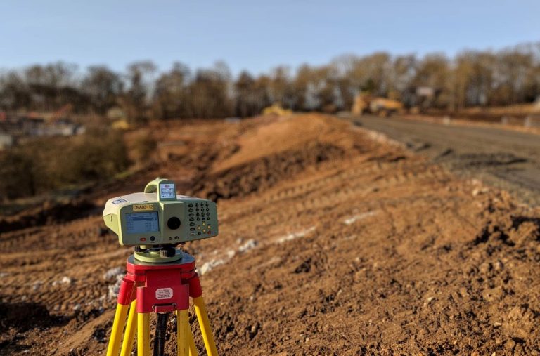
Depending on the type of survey required this can vary wildly. However, the typical process of Land Surveying involves the determination of distances and angles between points on land. In order to achieve this, Land Surveyors use traditional instruments and digital technology, to produce surveys, data and maps describing the Earth’s surface features.
Although, in it’s simplest form, it can involve just a string or measuring tape and recording observed distances.
How much does a Land Survey cost?
This is probably one of the most common questions asked by someone looking to get a survey done. It’s a question too complex to offer a simple answer to it. There are a variety of factors to be considered. Let’s try to break it down into the most common factors that influence the price of a survey.
- Size of the area in question. This is probably one of the most important factors to consider. The larger the area, the more expensive the survey becomes.
- Level of detail. This is specific to the type of survey you need. A simple diagram of land boundaries might not be as expensive as a full topographical survey.
- Legal fees. Often, when it comes down to boundary surveys or cadaster, there are fees associated with adding or amending the Land Registry of the local authority. These fees vary from place to place and the surveyor will add them on top of their quote.
- Urgency. More often than not, surveys then to be thought of last. Therefore they are required within short deadlines. And like everything else, time costs money.
Whilst there is no clear-cut answer on how much a survey will cost, you can take some precautions to make sure you don’t overspend. A few tips that might help include:
- Plan ahead of time and book the survey as early as you realise your project needs it. Don’t leave it to the last minute.
- Be clear with your requirements and communicate them to your surveyor. Mention what you need surveyed, to what level of detail, how the data should be presented, access requirements and purpose of the survey. This isn’t an exhaustive list, but provide any prior surveys or legal paperwork that is relevant.
- Don’t go for the cheapest surveying service you can find. Surveys are by nature precise products which require very well trained professionals to undertake. It is often the case that clients go for the cheapest solution, only to find themselves in the position that the survey is useless or not to the required specifications.
- Speak with multiple surveyors and ask for quotes. Find people with good references or trusted reviews.
With this I conclude the first half of this article. Please read the second part here in order to find out about Land Surveyors.
[…] surveys seems to be caused by the lack of understanding of prism constants. In today’s age of Land Surveying, the most commonly used targets contain a prism reflector that is used to return the signal back to […]
[…] is a continuation of the Land Surveying and Land Surveyors article. Here I will be discussing about Land Surveyors, their role in society and other […]
[…] not just topographical data, but also notes about your work. Good record keeping is a must have in land surveying, and this is best achieved by always taking essential field notes in your survey field […]
[…] is widely used in geomatics and land surveying to accurately determine the position and orientation of points on the Earth’s surface. This […]
This is an informative article that explains the importance of land surveying and the role of land surveyors in the field. It’s important to recognize that accurate land surveying is essential for various industries, from real estate to construction, and plays a crucial role in ensuring public safety.
[…] land surveying, accuracy is paramount. GPS time plays a crucial role in achieving this accuracy. By using GPS […]
[…] it comes to Land Surveying, if you use any sort of GNSS (GPS) equipment, you will deal with GNSS orbits even if you […]